- Mount Hanang Nature Forest Reserve- Travel TipsWhat to See, How to Plan & Tours
- Natural Scenery
- 5 Reviews
Guide to Climbing Mount Hanang Nature Forest Reserve
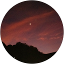
Mount Hanang Nature Forest Reserve encompasses 5,871 hectares of high-altitude forest and volcanic terrain in the Manyara Region of northern Tanzania. Reaching a peak elevation of 3,420 meters, Mount Hanang is the fourth-highest mountain in the country and serves as a critical water catchment area for the surrounding semi-arid Hanang District. Unlike the multi-day treks required for Kilimanjaro or Mount Meru, this dormant stratovolcano offers a rigorous single-day ascent that involves a vertical gain of approximately 1,600 meters from the base town of Katesh. The reserve was officially gazetted in 1936 and remains under the management of the Tanzania Forest Services Agency, which oversees both conservation efforts and tourism logistics for the area.
Geological Profile and Hiking Logistics
Volcanic Origins and Topography
Mount Hanang is an extinct stratovolcano located along the eastern arm of the Great Rift Valley, with its most recent geological activity dating back to the Pleistocene epoch. The mountain features steep slopes composed primarily of nephenlinitic lavas and carbonatitic tuffs, creating a rugged environment that contrasts sharply with the surrounding alkaline lakes. Hikers typically begin their journey in Katesh, which sits at roughly 1,800 meters above sea level, necessitating a relentless climb to reach the summit plateau. The western side of the reserve is characterized by jagged ridges and deep valleys, while the southern and eastern slopes support denser evergreen vegetation.
Trail Details and Entry Requirements
The Katesh Route is the most frequently used path for reaching the peak, covering a total round-trip distance of 17.5 kilometers. Most fit hikers require five to six hours for the ascent and approximately three hours for the return trip—though many choose to camp at the 3,100-meter mark to observe the sunrise. Entry fees for non-residents are set at 20 USD per day, which increases to 23.60 USD once the 18 percent Value Added Tax is applied. Visitors must pay these fees at the local Tanzania Forest Services office in Katesh before starting the climb, as rangers frequently patrol the lower forest boundaries. While the trail is not technically complex, the extreme incline and loose scree near the summit require sturdy footwear and high aerobic fitness.
Biodiversity and Indigenous Heritage
Unique Ecosystems and Endemic Species
The reserve protects a diverse range of habitats, from montane forests and bushland at lower elevations to moorlands and alpine heath above 2,700 meters. This isolated volcanic environment is home to the Hanang mole-rat (Fukomys hanangensis), a species discovered in 2017 that is found nowhere else on earth. Birdwatchers can identify over 400 species within the reserve, including the Hartlaub’s turaco and the cinnamon bracken warbler. Five permanent rivers originate within these high-altitude forests, providing the primary water supply for the downstream communities of Basotu and Gendabi. The seasonal shifts in weather often see the summit temperature drop below freezing at night, even during the dry season from June to October.
Cultural Connection to the Barabaig and Iraqw
Mount Hanang holds deep spiritual significance for the local Barabaig and Iraqw ethnic groups, who have utilized the mountain’s caves and forests for traditional rituals for generations. The Barabaig, a Nilotic pastoralist group also known as the Datoga, consider several high-altitude sites sacred and often visit the mountain to perform ceremonies or seek blessings. Visitors interested in the cultural history of the region can arrange tours that include demonstrations of traditional Barabaig dancing or visits to local pottery makers in the villages surrounding the reserve base. Understanding this local context is vital, as the mountain is viewed as a living ancestor rather than merely a recreational destination.
Frequently Asked Questions
When is the most favorable time to climb Mount Hanang?
The dry season from June to October provides the most stable weather and clear views of Lake Balangida from the summit. During the rainy months of March through May, the steep trails become exceptionally slippery and clouds often obscure the panoramic sights, making the 1,600-meter ascent significantly more dangerous.
Is it necessary to hire a professional guide for the trek?
While some experienced hikers attempt the route independently, hiring a TALA-licensed guide is strongly advised to ensure safety on the unmarked sections of the upper ridges. Local guides charge between 20 USD and 40 USD per group and provide essential navigation through the dense forest sections where trails can easily be lost.
How do I travel to Katesh from Arusha?
Public buses depart daily from Arusha to Katesh, a journey of approximately 240 kilometers that takes about four to five hours depending on road conditions. The town of Katesh serves as the primary gateway, with several budget-friendly guesthouses located within walking distance of the mountain’s south-western entrance gate.
What are the current permit costs for international visitors?
A single-day conservation permit for a non-resident adult costs 23.60 USD including VAT, while overnight camping permits incur an additional fee of roughly 35 USD. These payments are processed through the Government Electronic Payment Gateway, so travelers should ensure their guide or hotel helps them obtain the necessary control number for bank or mobile payment.
Operators offering tours in Tanzania
Attractions in Tanzania
- 1
- 2
- 3
- 4
- 11
Reviews of Mount Hanang
 Jurassic Man
 - 5
Brilliant mountain. Great views. One of the toughest climbs I have ever done. Well worth it. They are still fixing up the toilets at the last based camp before summit.
 Stephen Veryser
 - 5
Excellent two-day climb with Thomas Safari. Perfect weather in late June. Physically demanding considering it's a 1500m elevation change in 8km, quite steep though not technical.
 Meenu Andrea
 - 5
Beautiful place to hike ...with the help of a guide..Nice environment..View from the top is fantastic..u can see lots of mountain plants and flowers..we took one day to climb..we recommend this place for anyone who love hiking...
 emanuel kaminyoge
 - 5
At the summit you can have a great view of Great rift valley,Lake Manyara,Lake balangida Lehu,Lake Gendabi and Many More.
 Elisha Massebe
 - 5
The environmental is so good also there are fertile land for cultivation


